
CERC — Environmental Software and Services
- Overview
- Air pollution modelling
- ADMS 6
- ADMS-Roads (Extra)
- ADMS-Urban
- MAQS
- ADMS-Airport
- ADMS-Screen
- Feature comparison
- Emissions management
- EMIT
- Wind energy and airflow
- FLOWSTAR-Energy
- Accidental releases
- GASTAR
- LSMS
- ADMS-Puff
- ADMS-STAR
- Managing model runs
- Run Manager
- Model evaluation
- Model Evaluation Toolkit
- Meteorological data processing
- WRFtoMet
- Related Documentation
- User guides
- Technical specifications
- Model validation
- Newsletters
- Publications
- CERC co-author publications
- CERC software publications
- Presentations
- Other information
- Traffic emissions
- Prices
- Free demo
- Visualisation tools
- Current software versions
- System requirements

ADMS-STAR
Advanced software for modelling short-term accidental releases
What is ADMS-STAR?
ADMS-STAR uses a Lagrangian puff methodology to model the fate of explosive or finite duration releases to atmosphere. ADMS-STAR can use temporally and spatially varying meteorological data from the WRF model, vertical profiles of meteorological data or simple surface data. ADMS-STAR can also account for the impact of complex terrain: hills, variable surface roughness; and marine effects.
ADMS-STAR calculates instantaneous air concentration and accumulated wet and dry deposition for radiological or chemical emissions. These can be compared against regulatory or other levels (e.g. EU maximum permitted levels in foodstuffs).
ADMS-STAR can be used either in situations where the source details are known or it can perform a back calculation and estimate the source strength based on air or soil sample data.
ADMS-STAR has a link to ESRI's ArcGIS (Geographical Information System) for entering source and receptor data and displaying contours of concentration and/or deposition overlaid on a map of the area where the incident occurred.
Who uses ADMS-STAR?
Operators and regulators concerned with determining the impact of accidental releases of passive and buoyant material, in particular, radioactive species.
Why use ADMS-STAR?

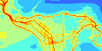
Contour animation of an example gas release at the North Sea modelled by ADMS-STAR.
ADMS-STAR has a user-friendly Windows interface, making it easy to set up the model and view results. The input data are arranged in a series of screens with default values provided for much of the information. This makes the model ideal for rapid data entry and use by non-specialists, e.g. in emergency situations.
The system has the following features:
- Advanced dispersion model in which the boundary layer structure is characterised by the height of the boundary layer and the Monin-Obukhov length, a length scale dependent on the friction velocity and the heat flux at the surface.
- Samples of air concentration or deposited material may be entered and the model will apply a back calculation to calculate the source strength. This can be useful in emergency scenarios where the actual characteristics of the source are not known.
- Built-in list of isotopes along with their half-life and daughter products allowing for the consideration of the effects of radioactive decay. This radioactive decay is also taken into account in the back calculation to determine the source strength.
- Built-in list of EU maximum permitted levels in foodstuffs which allows for easy comparison to regulatory levels. Contours showing where these levels are exceeded can be simply plotted over a map of the area using the link to ESRI's ArcGIS.